3D Laser Scanning
Our 3D Laser Scanning Surveys revolutionize the way we capture and deliver detailed spatial information for your projects. With our state-of-the-art Trimble X7 laser scanner, boasting a remarkable range of 0-60m, accuracy of ~2mm, and eliminating human error, we bring unparalleled precision to your Measured Building Surveys and topographical surveys.
Introduction To 3D Laser Scanning Surveys
The advent of laser scanning has ushered in a new era in the surveying industry, enhancing the accuracy and efficiency of data collection on-site. Island Survey Systems takes pride in incorporating the latest technology to provide you with comprehensive 3D point clouds. Within minutes, our Trimble X7 laser scanner captures millions of data points, creating a detailed and accurate representation of the surveyed area.
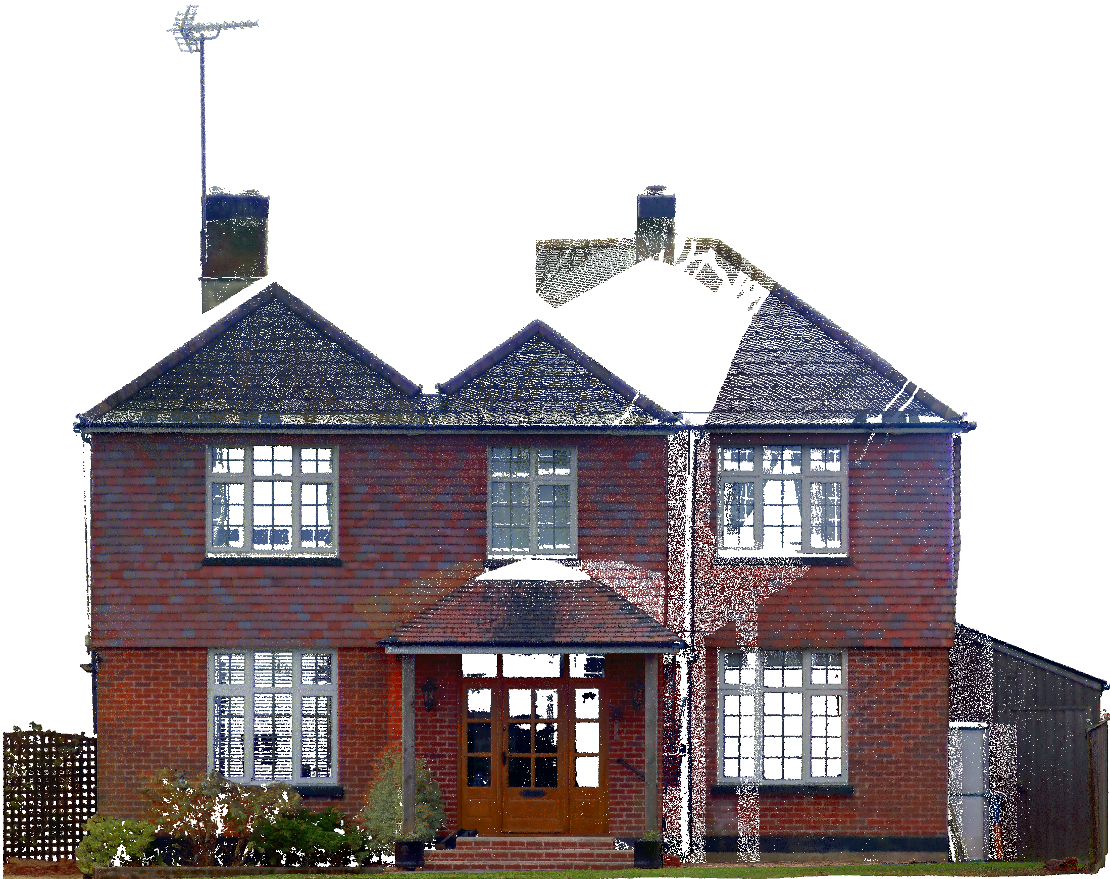
Please Click the pointcloud image below to view in 3D.
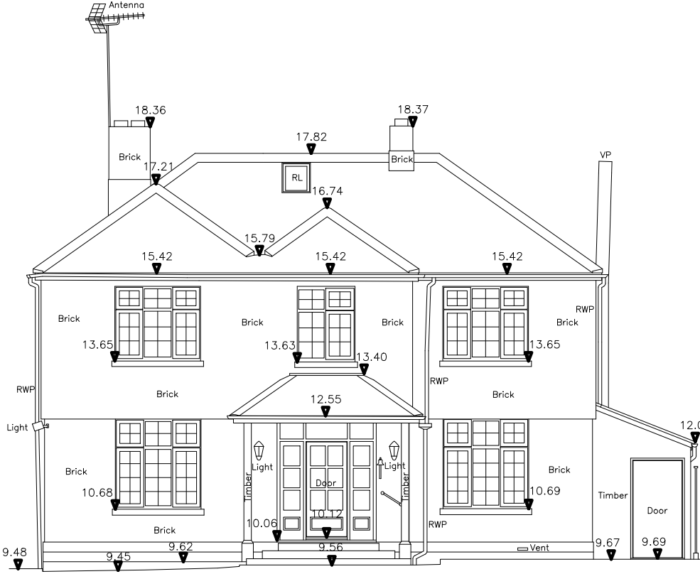
Unrivaled Precision In 3D Models & 2D Drawings
Our laser scanning surveys empower us to produce exceptionally precise 3D models and 2D drawings tailored to your project requirements. Whether you need topographical surveys, floor plans, ceiling plans, elevation drawings, or sections, our advanced technology ensures a level of detail that surpasses traditional surveying methods. The Trimble X7’s accuracy and range guarantees that every feature is captured with meticulous precision, providing you with a reliable foundation for your design and planning processes.
Trimble X7: The Pinnacle Of Laser Scanning Technology
At the heart of our 3D Laser Scanning Surveys is the Trimble X7, a cutting-edge laser scanner designed for unmatched performance. With a range of 0-60m, this instrument is capable of capturing data across various scales, from intricate indoor spaces to expansive outdoor environments. The accuracy of approximately 2mm ensures that every data point is reliable and true to the real-world conditions, allowing you to make informed decisions based on a solid foundation.
Perhaps most notably, the Trimble X7 eliminates human error from the surveying equation. The technology employed ensures consistency in data capture, minimizing the risk of inaccuracies that may arise from traditional surveying methods. This not only enhances the quality of our surveys but also accelerates the surveying process, saving you time and resources.
Enhancing Your Measured Building Surveys & Topographical Surveys
Island Survey Systems is dedicated to delivering results that exceed expectations. Our 3D Laser Scanning Surveys are seamlessly integrated into Measured Building Surveys and topographical surveys, offering a comprehensive solution for architects, engineers, and project managers. The precision of our data ensures that you receive accurate and reliable information, empowering you to make informed decisions throughout the project lifecycle.
In conclusion, Island Survey Systems combines expertise with state-of-the-art technology to bring you 3D Laser Scanning Surveys that set a new standard in precision and efficiency. Our Trimble X7 laser scanner, with its impressive range, accuracy, and elimination of human error, ensures that your projects benefit from the most advanced surveying capabilities available.
Contact Island Survey Systems
If you’re interested in getting a Free Quote or to find out more information about our 3D Laser Scanning Surveys, please Contact Island Survey Systems today and our friendly team will help you.